
Deliverables
Premium outputs built for exploration decisions.
Xidar deliverables turn satellite evidence, terrain context, structural interpretation, prospectivity ranking, and target logic into clear technical packages for field teams, executives, partners, and diligence reviewers.
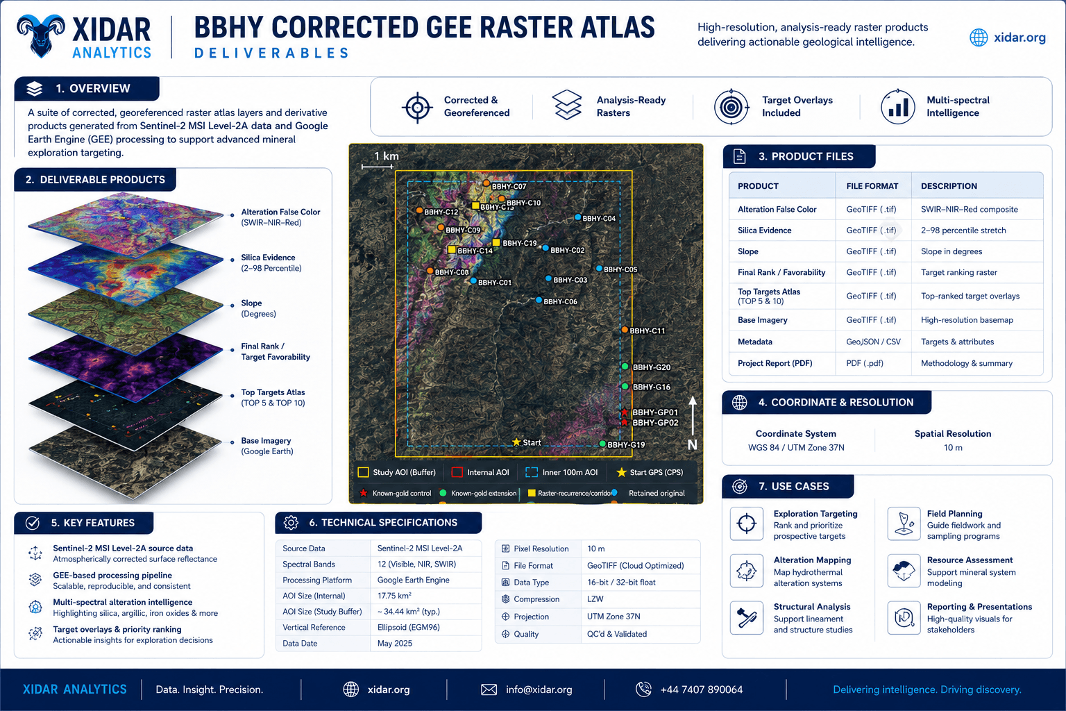
Deliverable atlas
From individual raster products to a complete decision package.
The deliverables system is modular: clients can receive lightweight screening frames, full raster atlases, ranked target outputs, GIS-ready tables, executive summaries, or a final technical report depending on the decision need.
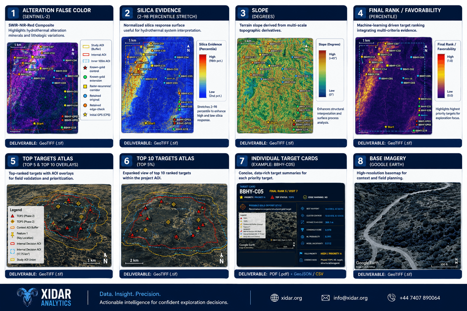
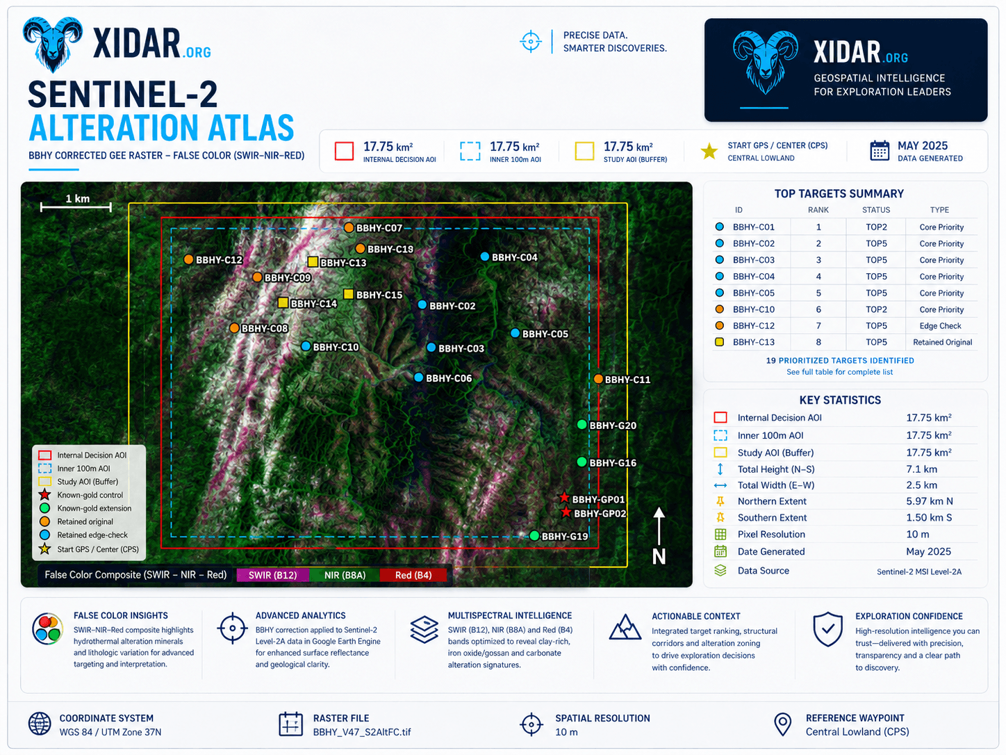
Alteration false color
GeoTIFF / map plateSWIR-NIR-red composites for hydrothermal alteration, lithologic variation, and visual interpretation.
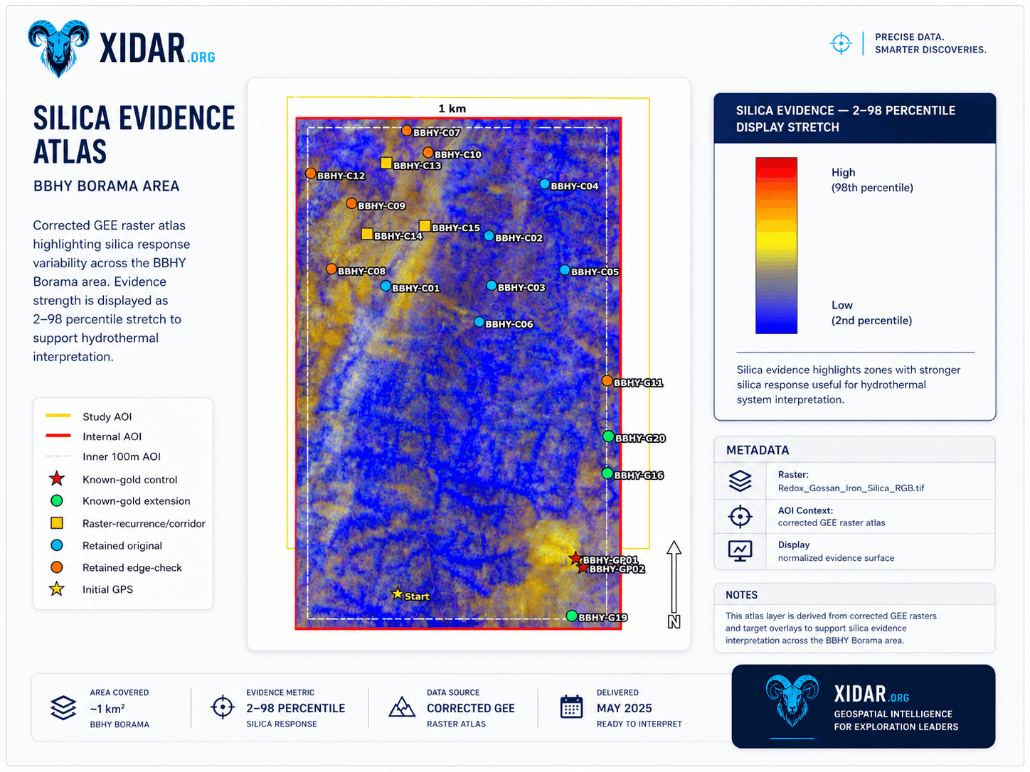
Silica evidence
GeoTIFF / percentile layerNormalized silica response surfaces that help highlight potential silicification and hydrothermal context.
Slope and terrain
GeoTIFF / terrain derivativeTopographic derivatives that support structural reading, access planning, drainage context, and field navigation.
Final rank and favorability
GeoTIFF / ranked rasterIntegrated favorability scores that combine multiple evidence streams into a target-prioritization layer.
Top targets atlas
Map packageTop 5 and Top 10 overlays that translate model outputs into map-led target discussion for exploration teams.
Individual target cards
PDF + CSV + GeoJSONConcise target summaries with geometry, rank, evidence notes, uncertainty, and recommended next-step logic.
Base imagery and context
Basemap / review frameHigh-resolution visual context for orientation, field planning, route discussion, and stakeholder review.
Technical report and deck
PDF / presentationDecision-ready narrative linking datasets, interpretation, ranked targets, limitations, and field-validation plan.
Typical product files
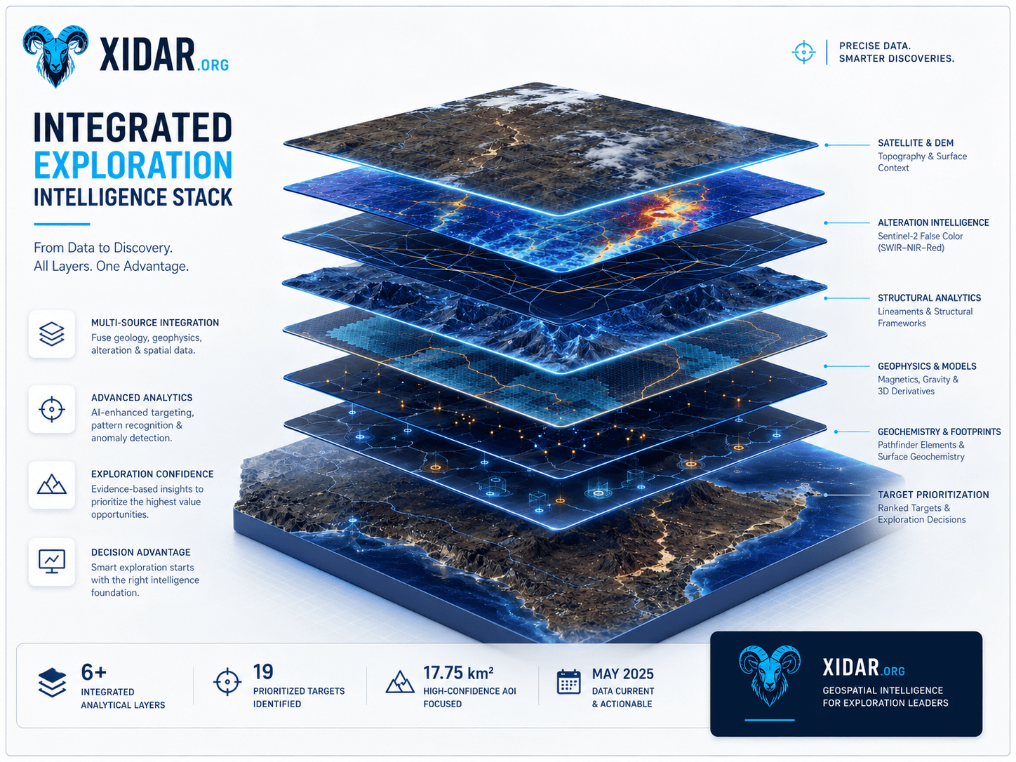
The value is not one map. It is the handoff between layers.
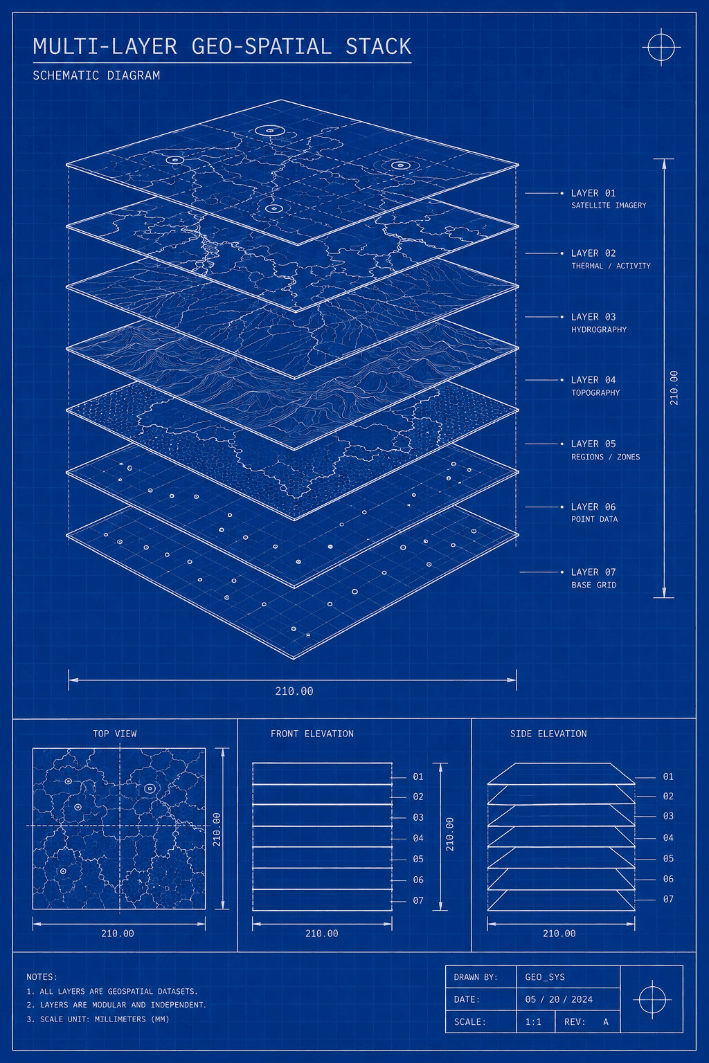
Xidar deliverables are designed around evidence integration: satellite imagery, terrain derivatives, spectral alteration, structural fabrics, corridor logic, geochemical context where available, target ranking, and implementation planning.
- Multi-source integration
- Ranked target outputs
- Presentation-ready narrative
- GIS-ready handoff
Package depth
Deliverables scale from a quick screen to a full technical report.
Each tier can be shaped around commodity, AOI size, available datasets, confidentiality needs, and whether the output is for field teams, management, or external technical review.
Screener
Fast viability package
- Overview map
- Convergence raster preview
- Basemap/data-quality review
- Go/no-go summary
Mapper
Interpretation package
- Structural map set
- False-colour composites
- Terrain and lineament interpretation
- Field guidance notes
Targeter
Ranking package
- Prospectivity maps
- Ranked target list
- Target rationale
- Field-priority logic
Strategist
Decision package
- Executive dashboard
- Ranking matrix
- Priority map set
- Phased follow-up programme
Enterprise
Custom intelligence package
- Interactive map portal
- GIS package
- Recurring monitoring
- Custom report and stakeholder briefing
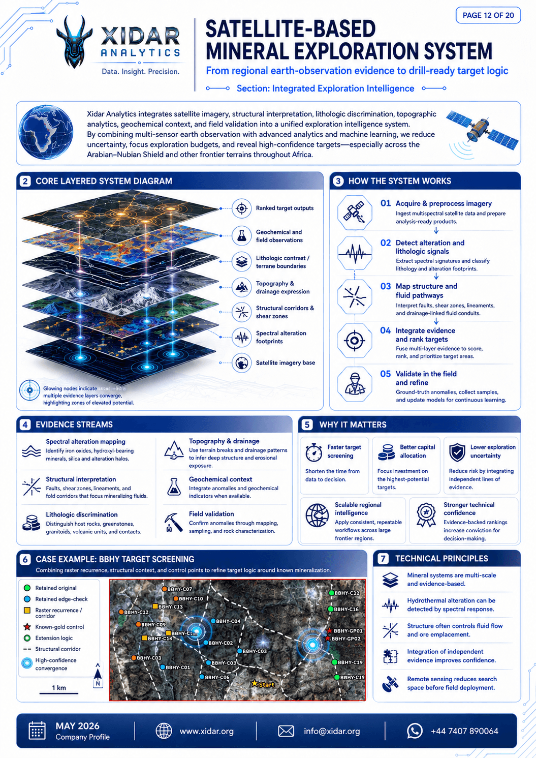
Blueprint-style outputs help teams understand systems, not only screenshots.
For higher tiers, Xidar can include system diagrams, layered workflows, operations maps, methodology pages, and handoff notes so a technical reviewer can understand how the evidence stack was assembled and where uncertainty remains.
Interpretation with caveats
Desktop outputs support diligence and prioritization. They require geological review, field validation, sampling, QA/QC, and project-specific assessment before operational or investment decisions.
Public-safe sample handling
Representative samples may be anonymised. Exact coordinates, licence boundaries, client identifiers, and sensitive target details can be withheld or generalised for public viewing.
Formal review pathway
Outputs can be formatted for review by a Qualified Person or Competent Person where formal disclosure is required, without implying automatic disclosure readiness.