
Governance hub
Toronto, Canada
Corporate structure, scope control, commercial accountability, and investor-facing coordination.
Xidar Analytics is a Canada-based mineral exploration intelligence and technical advisory firm focused on frontier terranes, the Horn of Africa, and the Arabian-Nubian Shield.
Data. Insight. Precision.

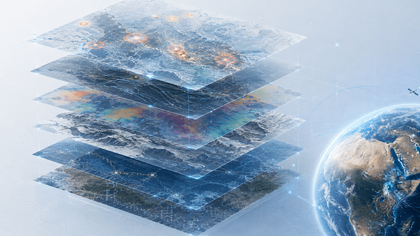
Satellite imagery, structural interpretation, terrain evidence, and field-validation planning in one decision workflow.
The era of easy outcropping discoveries is largely behind the industry. Modern exploration demands stronger targeting before field programs, logistics, sampling, and drilling budgets begin to scale.
Xidar brings satellite remote sensing, geological interpretation, regional operating knowledge, and field-aware advisory into one practical decision pipeline.
The result is a cleaner route from broad screening to ranked targets, governed sampling, laboratory integration, and commercially useful reporting.
Corporate structure, scope control, commercial accountability, and investor-facing coordination.
A coordination footprint across London, Bristol, Hargeisa, Addis Ababa, Mogadishu, Lusaka, and Dubai keeps planning closer to terrain, markets, and technical partners.
A staged evidence chain connects desktop targeting, field verification, sample governance, and assay integration.
We support exploration partners through geospatial intelligence, spectral analysis, structural interpretation, field verification logic, and integrated drill-targeting support.
The public story stays concise. The delivery model stays disciplined from first screening through technical handoff.

Imagery, terrain, structure, geology, and field context are read together before larger commitments begin.
Each phase narrows uncertainty so clients can move from regional screening to field-ready priorities with clearer logic.
Desktop intelligence is shaped by practical operating knowledge across frontier terranes and the Arabian-Nubian Shield.
Outputs are structured for technical review, investor discussion, field planning, and next-step accountability.
Xidar Analytics operates as a registered General Partnership in Ontario, Canada, under the geophysical surveying and mapping services classification.
Remote sensing is strongest when it is interpreted through geological context.
Field verification protects teams from over-investing in weak or ambiguous anomalies.
Sampling and assay workflows are more useful when they are connected back to the original target logic.
Field continuity, laboratory integration, and output structure remain visible throughout the engagement.
